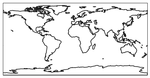
Landmask (NaturalEarth)
The outline of the landmask is obtained from Natural Earth. It is automatically downloaded, cached[1] and opened with geopandas. The following landmasks are currently available:
Land 1:110m
Land 1:50m
Land 1:10m
Note
If available, it is better to use the landmask of the used data set.
Import regionmask:
In [1]: import regionmask
Landmask
Warning
natural_earth_v4_1_0.land_50 and natural_earth_v5_0_0.land_50
do not extend all the way to 90°S (see #487).
If Antarctica is of interest, please use natural_earth_v5_1_2.land_50 instead.
Be careful, however, as the regions may have changed between the natural_earth versions.
Note that land_10 and land_110 do not exhibit this problem.
In [2]: land = regionmask.defined_regions.natural_earth_v5_0_0.land_110

In [3]: land.plot(add_label=False)
Out[3]: <GeoAxes: >